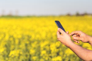
Ecological Momentary Assessment has been in used since the 1940s but only recently has the technology allowed for a deep understanding of the survey respondent’s local environment. Previously the “ecological” advantage of EMA was that researchers knew that the respondent was not in the lab but in one of their everyday locations (e.g. work, home, commuting etc.) and thus were sampling experience in a real-world setting. The Smartphone allows us to do a lot more to understand the immediate environment of the respondent.
LOCATION
Most EMA companies are now capturing location data as GPS coordinates. mEMA capture GPS coordinates when a survey is completed and optionally on a periodic basis (e.g. for 1 minute every 10 minutes), on a time interval basic (e.g. once every 20 minutes) or when a specific degree of location change is detected (e.g. every 10 meters). mEMA also tells us which location services are available at any time coordinates are take, for example, is satellite available or only cell or WiFi networks. If satellite is available it will use that to capture the longitude and latitude as we have consistently found it to be more accurate. In either case the mEMA app tells you which source it used to capture location and the accuracy (in meters) reported by that source. All this data is available to you in its raw format or we can clean it up for you filtering out, for example, data points with an accuracy less than any threshold you define. Once captured, location data can then be used to collect a variety of other data points or applied to the delivery of context-aware or just-in-time interventions. For example, the mEM platform utilizes GPS coordinates to integrate with third party databases to access local weather conditions at the time of the survey. GPS data can be used in real-time to tell the system when a respondent is in a target location and trigger a survey or intervention content (geofencing).
IMMEDIATE SENSORY ENVIRONMENT
Most phones have the ability to collect a wide range of data about the immediate environment surrounding a respondent. Many EMA companies provide the ability for respondents to take a photo, video or audio recording that you can use to gain a deeper understanding of where respondents are. mEMA goes a step further. We collect light and noise levels detected by the phone’s camera and microphone. We can also collect barometric pressure, humidity, altitude and temperature.
SOCIAL ENVIRONMENT
An additional level of analysis takes the audio samples collected from the microphone and distinguishes the human voice from other sounds. If a human is speaking within microphone range you will see that in the data table. We can also detect the presence of other mEMA users if you are interested in the interactions of study participants with each other. The mEMA app also has the ability, with the user’s permission, to access the SMS and call log so we know when texts and calls are being sent and received. On Android we can also see what other apps are in the foreground at any time so can look for the use of social media apps or any other apps of specific interest.
MOTION
All Smartphones are equipped with 3-axis accelerometers. mEMA collects raw data from the accelerometers and can provide you with “average acceleration”. mEMA also has a built in pedometer which uses Android’s algorithms to calculate how many “steps” have been taken. The ilumivu infrastructure allows us to easily add new sensing capabilities as they are requested or become available on the different phones. All the data are timestamped and connected with the anonymized subject ID so they can easily combined with the self-report data collected from the mEMA app.
